


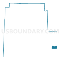
Voting District 100005, Steuben County, New York
About
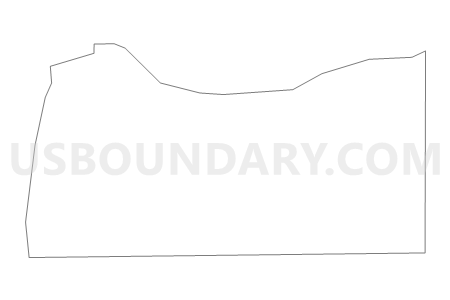
Outline

Summary
| Unique Area Identifier | 636799 |
| Name | Voting District 100005 |
| County | Steuben County |
| State | New York |
| Area (square miles) | 6.79 |
| Land Area (square miles) | 6.79 |
| Water Area (square miles) | 0.00 |
| % of Land Area | 99.93 |
| % of Water Area | 0.07 |
| Latitude of the Internal Point | 42.10166750 |
| Longtitude of the Internal Point | -77.01747580 |
Maps

Graphs
Select a template below for downloading or customizing gragh for Voting District 100005, Steuben County, New York


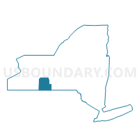
Neighbors
Neighoring Voting District (by Name) Neighboring Voting District on the Map
- Voting District 030201 030206, Chemung County, NY
- Voting District 080001, Steuben County, NY
- Voting District 080002, Steuben County, NY
- Voting District 100001 100004, Steuben County, NY
- Voting District 100002, Steuben County, NY
Top 10 Neighboring County Subdivision (by Population) Neighboring County Subdivision on the Map
- Big Flats town, Chemung County, NY (7,731)
- Corning town, Steuben County, NY (6,270)
- Caton town, Steuben County, NY (2,179)
Top 10 Neighboring Place (by Population) Neighboring Place on the Map
Top 10 Neighboring Unified School District (by Population) Neighboring Unified School District on the Map
Top 10 Neighboring State Legislative District Lower Chamber (by Population) Neighboring State Legislative District Lower Chamber on the Map
Top 10 Neighboring State Legislative District Upper Chamber (by Population) Neighboring State Legislative District Upper Chamber on the Map
Top 10 Neighboring 111th Congressional District (by Population) Neighboring 111th Congressional District on the Map
Top 10 Neighboring Census Tract (by Population) Neighboring Census Tract on the Map
- Census Tract 103, Chemung County, NY (7,731)
- Census Tract 9630, Steuben County, NY (4,146)
- Census Tract 9629, Steuben County, NY (2,727)